GeoTag Photos with GeoSetter
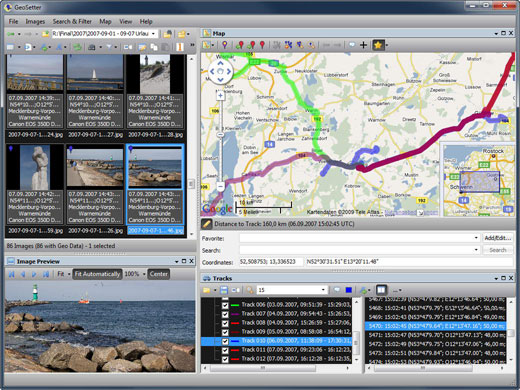
Being able to document the geographic location of your photos is great for putting together a story about a trip or simply for jogging your memory at some point in the future. GeoSetter makes the process of geotagging your photos easier by allowing you to search for a location in Google Maps and setting EXIF data in the photo file with the latitude and longitude of the location. Once you tag the photos, GeoSetter can show you a route map for related photos, or multiple routes if you have several clusters of photos, creating a sort of online photo walk that recreates your trip. GeoSetter is compatible with the LOCR geotagging photo community, so you can share your photos with other people who have a common interest in geotagging.
Altitude information is downloaded about locations when Google Maps is used for automatic inclusion of latitude and longitude data, which is particularly helpful for mountain hiking and other nature photography. Once you get your photos tagged with latitude and longitude information, you can export the info for viewing in Google Earth, in addition to viewing on a Google Map in GeoSetter.